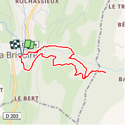
![](/images/other/stat-length.png)
![Tour Wandern La Bridoire - Au fil du Ruisseau du Grenant - La Bridoire - Photo](https://media.geolcdn.com/t/1900/400/ext.pjpeg?maxdim=2&url=https%3A%2F%2Fservices.sitytrail.com%2FGeolivesWS%2FDownloadMedia.ashx%3FTrailID%3D191474%26Media%3D15066_1.jpg)
Au fil du Ruisseau du Grenant - La Bridoire
tracegps
Benutzer
![Länge](/images/other/stat-length.png)
![Maximale Höhe](https://static1.geolcdn.com/siteimages/upload/files/1508320355ic_sort_altitude_max_24dp.png)
![Positive Höhendifferenz](https://static1.geolcdn.com/siteimages/upload/files/1508320355ic_sort_den_pos_24dp.png)
![Km-Effort](/images/other/stat-length.png)
![Min. Höhe](https://static1.geolcdn.com/siteimages/upload/files/1508320355ic_sort_altitude_min_24dp.png)
![Negative Höhendifferenz](https://static1.geolcdn.com/siteimages/upload/files/1508320355ic_sort_den_neg_24dp.png)
![Boucle](https://static1.geolcdn.com/siteimages/upload/files/16400158638029165_repeat_loop_refresh_sync_direction_icon.png)
![Wandern](https://static1.geolcdn.com/sitytour/trail-icons/101.png)
1h30
Schwierigkeit : Einfach
![Scannen Sie diesen QR-Code, um die Tour in der SityTrail-Anwendung zu öffnen](https://capi.geolives.com/qq0zvz2zws4bq2lad0pu/sitytour/trails/191474/qr.png?size=200)
Kostenlosegpshiking-Anwendung
Über SityTrail
Tour Wandern von 3,8 km verfügbar auf Auvergne-Rhone-Alpen, Savoyen, La Bridoire. Diese Tour wird von tracegps vorgeschlagen.
Beschreibung
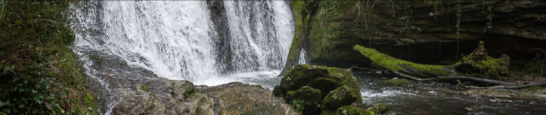
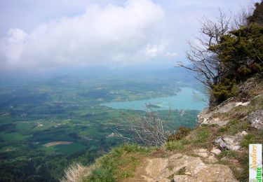
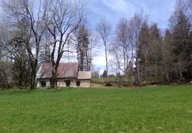
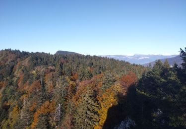
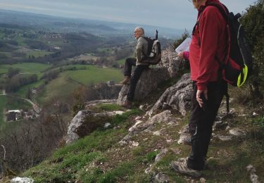
Le Ruisseau du Grenant est l'occasion d'une promenade printanière agréable et pittoresque depuis la Bridoire. Le parcours emprunte l'escalier au dessus de l'église et trouve la route de l'école pour prendre le sentier de la cascade en rive droite du Ruisseau du Grenant. Sous le pont de chemin de fer, le sentier débouche sur le chemin des Combes qui conduit à la Ferme des Combes. Une passerelle traverse le ruisseau au-dessus de la ferme. Le sentier de la tannerie Rougy offre de beaux points de vue sur les Combes. Le retour par les Roches et les Gavans rejoint rapidement le point de départ. Description complète sur sentier-nature.com : Au fil du Ruisseau du Grenant, la Bridoire
Ort
Kommentare
Touren in der Umgebung
![Tour Wandern Attignat-Oncin - Le Mont Grelle 1425m, depuis Attignat - Oncin - Photo](https://media.geolcdn.com/t/375/260/ext.jpg?maxdim=2&url=https%3A%2F%2Fservices.sitytrail.com%2FGeolivesWS%2FDownloadMedia.ashx%3FTrailID%3D102436%26Media%3D3086_1.jpg)
![Wandern Wandern](https://static1.geolcdn.com/sitytour/trail-icons/101.png)
Wandern
![](/images/other/stat-length.png)
![](https://static1.geolcdn.com/siteimages/upload/files/16400158638029165_repeat_loop_refresh_sync_direction_icon.png)
![Tour Wandern La Bauche - Ballade vers la Bauche - Photo](https://media.geolcdn.com/t/375/260/beac6041-f762-4265-baf1-b8a107f85ed8.jpg&format=jpg&maxdim=2)
![Wandern Wandern](https://static1.geolcdn.com/sitytour/trail-icons/101.png)
Wandern
![](/images/other/stat-length.png)
![](https://static1.geolcdn.com/siteimages/upload/files/16400158638029165_repeat_loop_refresh_sync_direction_icon.png)
![Tour Pfad La Bauche - Mont Beauvoir - Photo](https://media.geolcdn.com/t/375/260/d3426012-2a94-4a47-accc-9d6f7ade0a85.jpg&format=jpg&maxdim=2)
![Pfad Pfad](https://static1.geolcdn.com/sitytour/trail-icons/104.png)
Pfad
![](/images/other/stat-length.png)
![](https://static1.geolcdn.com/siteimages/upload/files/16400158638029165_repeat_loop_refresh_sync_direction_icon.png)
![Tour Motorrad Lépin-le-Lac - GTA 2018 - ETAPE 10 - Photo](https://media.geolcdn.com/t/375/260/d636625f-16c9-4b72-bede-cfd3dfc1c816.jpg&format=jpg&maxdim=2)
![Motorrad Motorrad](https://static1.geolcdn.com/sitytour/trail-icons/402.png)
Motorrad
![](/images/other/stat-length.png)
![](https://static1.geolcdn.com/siteimages/upload/files/16400158638029165_repeat_loop_refresh_sync_direction_icon.png)
![Tour Wandern Attignat-Oncin - Le Mont Grelle (Boucle) - Photo](https://media.geolcdn.com/t/375/260/ext.jpg?maxdim=2&url=https%3A%2F%2Fservices.sitytrail.com%2FGeolivesWS%2FDownloadMedia.ashx%3FTrailID%3D961370%26Media%3Dfix__20180508124323.jpg)
![Wandern Wandern](https://static1.geolcdn.com/sitytour/trail-icons/101.png)
Wandern
![](/images/other/stat-length.png)
![](https://static1.geolcdn.com/siteimages/upload/files/16400158638029165_repeat_loop_refresh_sync_direction_icon.png)
![Tour Fahrrad Lépin-le-Lac - Autour du lac d'Aiguebelette - Lépin-le-Lac - Photo](https://media.geolcdn.com/t/375/260/ext.jpg?maxdim=2&url=https%3A%2F%2Fservices.sitytrail.com%2FGeolivesWS%2FDownloadMedia.ashx%3FTrailID%3D317073%26Media%3D16218_6.jpg)
![Fahrrad Fahrrad](https://static1.geolcdn.com/sitytour/trail-icons/200.png)
Fahrrad
![](/images/other/stat-length.png)
![](https://static1.geolcdn.com/siteimages/upload/files/16400158638029165_repeat_loop_refresh_sync_direction_icon.png)
![Tour Wandern Dullin - 2024 02 22 Dullin Follaton - Photo](https://media.geolcdn.com/t/375/260/4ef08341-aee2-4ed8-9922-cd4d10054a4b.jpg&format=jpg&maxdim=2)
![Wandern Wandern](https://static1.geolcdn.com/sitytour/trail-icons/101.png)
Wandern
![](/images/other/stat-length.png)
![](https://static1.geolcdn.com/siteimages/upload/files/16400158638029165_repeat_loop_refresh_sync_direction_icon.png)
![Tour Wandern Saint-Franc - Boucle autour de saint Franc - Photo](https://media.geolcdn.com/t/375/260/2456400f-9b7b-4b56-b909-1aec069c50cf.jpg&format=jpg&maxdim=2)
![Wandern Wandern](https://static1.geolcdn.com/sitytour/trail-icons/101.png)
Wandern
![](/images/other/stat-length.png)
![](https://static1.geolcdn.com/siteimages/upload/files/16400158638029165_repeat_loop_refresh_sync_direction_icon.png)
![Tour Wandern La Bridoire - GRENANT-G1-26-0623 - Photo](https://media.geolcdn.com/t/375/260/d1213f98-7b88-4a57-8f2f-e836b051ffee.jpg&format=jpg&maxdim=2)
![Wandern Wandern](https://static1.geolcdn.com/sitytour/trail-icons/101.png)
Wandern
![](/images/other/stat-length.png)
![](https://static1.geolcdn.com/siteimages/upload/files/16400158638029165_repeat_loop_refresh_sync_direction_icon.png)